ARIZONA DRONE
Drone Land Mapping

Add Boundary Lines or Rows of Agriculture from Aerial Imagery

I capture high-resolution aerial images of your land parcel and deliver annotated maps with clear markings.

Example #1: Parcel capture + boundary overlay

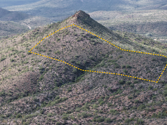
Slide to compare the original aerial and the boundary-marked deliverable.

Parcel 1 aerial photo Parcel 1 with boundary lines
With property lines Before

Example #2: Land view + clear boundary marking

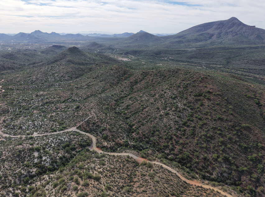
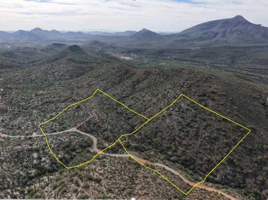
Perfect for marketing, planning, and communicating lot lines.

Parcel 2 aerial photo Parcel 2 with boundary lines
With property lines Before

Example #3: Farm capture + crop overlay

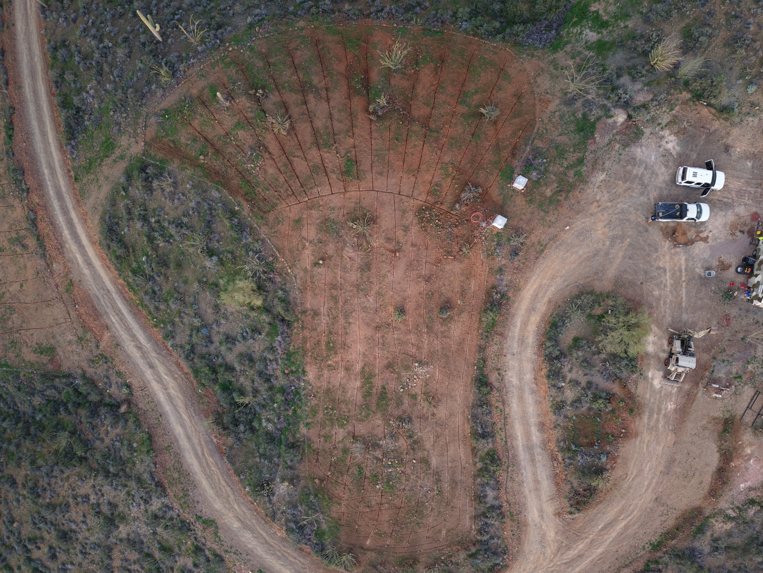
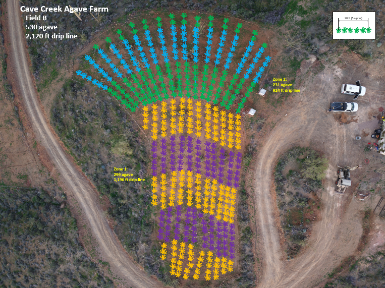
Slide to compare the original aerial and the crop-marked deliverable.

Field aerial photo Field with crop marking
With markings Before

Example #4: Field aerial + plant marking

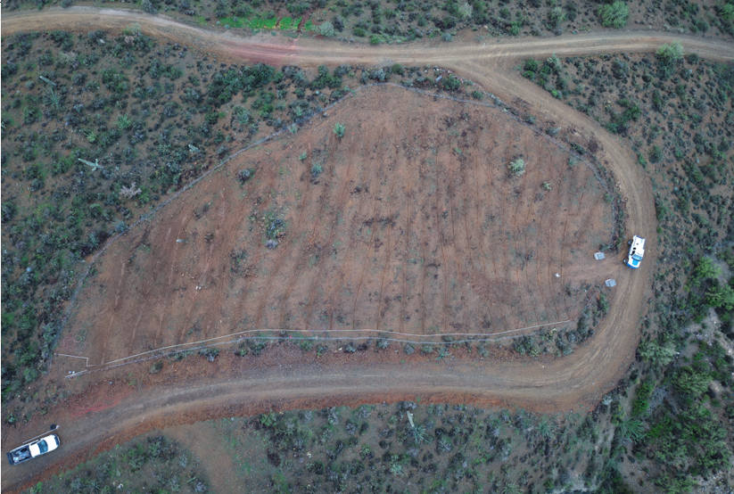
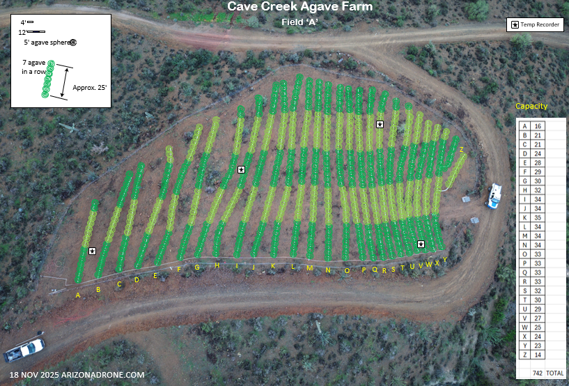
Perfect for planning and communicating farm activities.

Field aerial photo Field with plant markings
With markings Before
STEP 1
Share location

Send an address or pin drop and what you want highlighted.

STEP 2
Drone capture

I fly the parcel and capture crisp, high-resolution aerials.

STEP 3
Overlay & annotate

I add clean boundary lines and optional labels or callouts.

STEP 4
Delivery

You get share-ready images (JPG/PNG) and options for revisions.